Apple Maps Transit Info Launches in San Diego, California and British Columbia, Canada
July 25, 2016 by macjeff
Earlier in July, Apple Maps picked up transit information for Honolulu, Hawaii and Kansas City, Missouri. The expansion continues yet again.
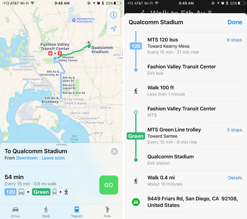
Today, it’s been confirmed that Apple Maps transit information has expanded to two very different locations. That includes San Diego, California and many areas within British Columbia, Canada. In San Diego, specifically, transit information includes routes for the city’s trolley, which connects the East and South counties with downtown. There are buses in the area, but the trolley serves as the main light rail system.
In British Columbia, transit information is available in Vancouver, Victoria, and a variety of other cities. Transit info includes routing information for the rail systems in those cities, including the SkyTrain.
Recently, Maps picked up transit info for Atlanta, Georgia, and Miami, Florida, as well as adding support for the United Kingdom’s National Rail. On top of those new cities, Apple Maps has also added Portland, Oregon; Seattle, Washington; and Sacramento, California. Apple also added transit data in Rio de Janeiro ahead of the Summer Olympics, and Montreal got support earlier this year as well.
Source link: http://www.iphonehacks.com/2016/07/maps-transit-san-diego-launch.html


Write a comment